SAR Geodesy
SAR Geolocation and Coregistration
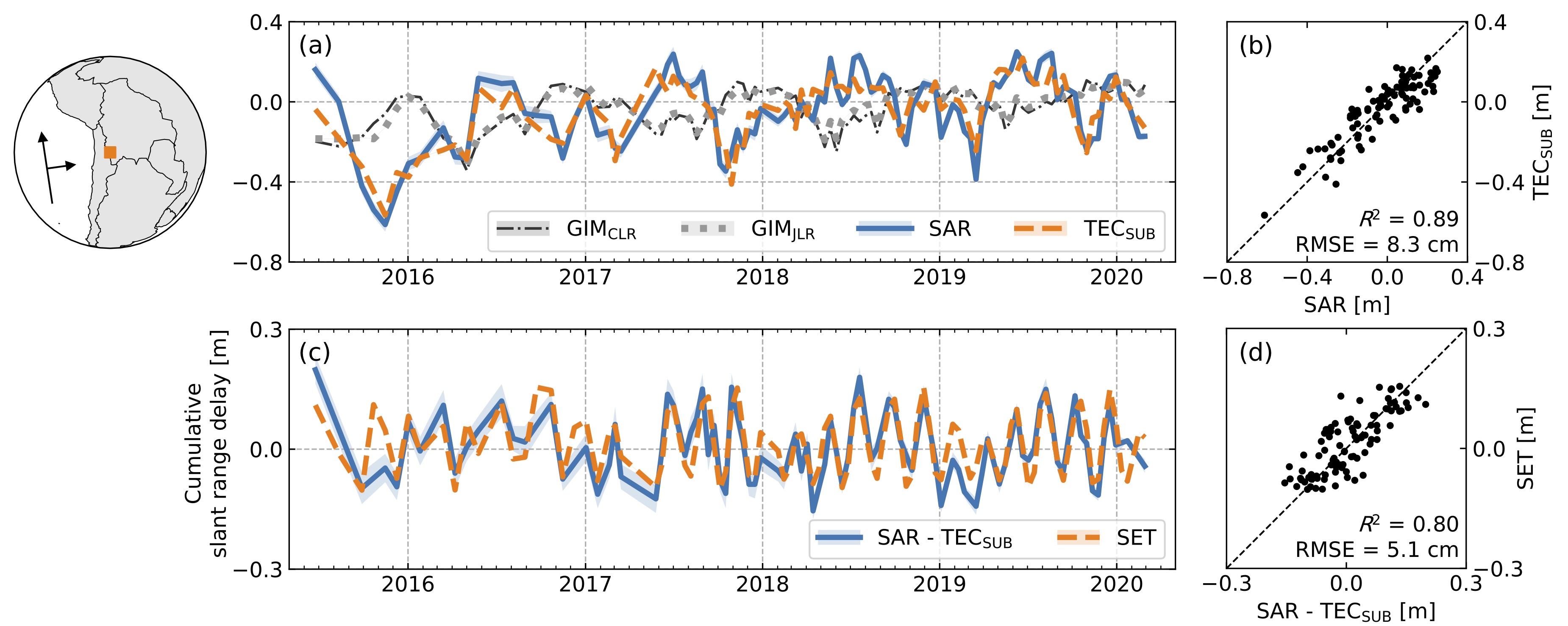
SAR/InSAR time series analysis generally starts with coregistration. Here we introduce a model-adjusted geometrical image coregistration (MAGIC) algorithm for stack coregistration. This algorithm corrects for atmospheric propagation delays and known surface motions using existing models (as shown below). We validate this approach by evaluating the impact of different geolocation errors on stacks of C-band Sentinel-1 and L-band ALOS-2 data, with a focus on the ionosphere. The results demonstrate that for Sentinel-1, the MAGIC approach is accurate enough in the range direction for most applications including interferometry. Check more details in Yunjun et al. (2022).
- We developed a Python wrapper for the solid Earth tides correction. The code is open-sourced and freely available on GitHub at https://github.com/insarlab/PySolid.
Phase Unwrapping Error Correction
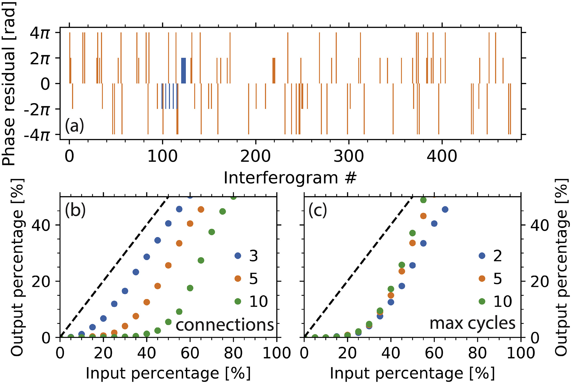
The estimated InSAR time-series can be potentially biased by wrong integer numbers of cycles (2π rad) added to the interferometric phase during the two-dimensional phase unwrapping, to which we refer simply as unwrapping errors. We develop the following two methods to automatically correct unwrapping errors using constraints from the space and time domain, respectively. Check more details at Yunjun et al. (2019) and Oliver-Cabrera et al. (2021).
- The bridging method connecting reliable regions with minimum spanning tree bridges.
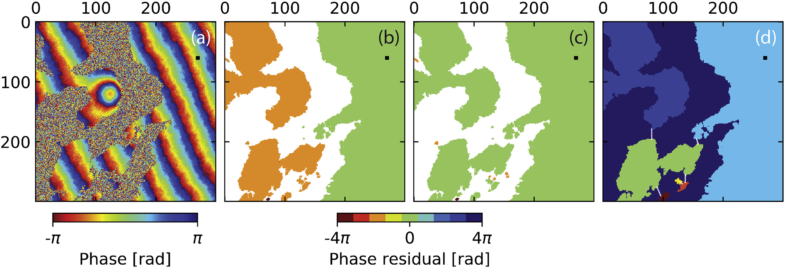
- The phase closure method exploiting the conservativeness of the integer ambiguity of interferogram triplets.
InSAR Time Series Analysis
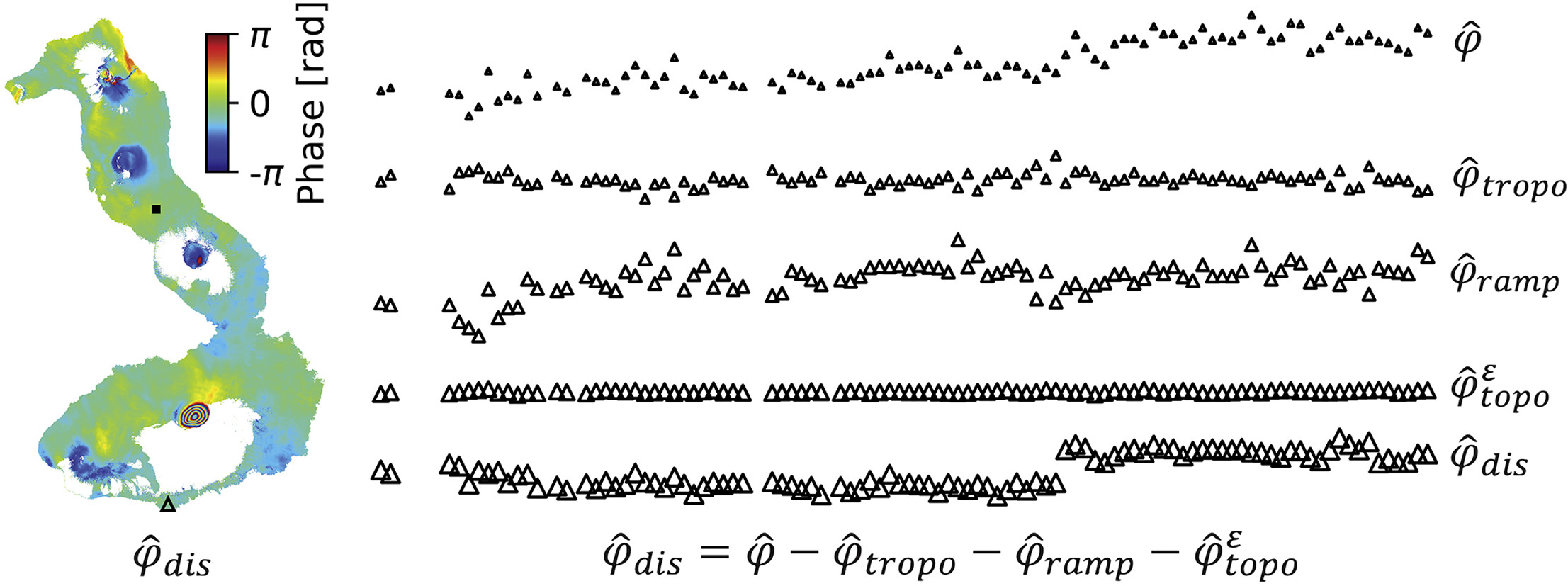
We present a review of small baseline interferometric synthetic aperture radar (InSAR) time series analysis with a new processing workflow and software implemented in Python, named MintPy. The basic idea is to apply the phase corrections in the time series domain (as shown below), instead of the traditional interferogram domain, to leverage the small orbital tubes and regular sampling of modern SAR satellites, for more efficient computing, in addition to a few more features. Check more details in Yunjun et al. (2019).
- The code is open-sourced and freely available on GitHub at https://github.com/insarlab/MintPy with documentation, tutorials in Jupyter Notebooks and test data. The software has been widely used in the science community, including the UNAVCO/EarthScope InSAR short course since 2019.